|
Up until now there was no sure way to check if your mission was going to result in a crash. You would have to place Waypoints at an altitude higher then surrounding obstacles like trees and buildings but could only be sure if this was calculated correctly by running a test flight. This was often time consuming and not 100% safe. However, Albert and I recently launched a new tool called The Bridge which allows you to plan your mission in Google Earth. Using Google Earth to plan a mission has a huge number of advantages and the Bridge taps into this by generating a Safety Checker file. When you open this file in Google Earth it shows you the exact flight path that Litchi will use with the ability to zoom in and move around in 3D to see if the flight path has sufficient obstacle clearance. As you can see from the example below the flight path has sufficient clearance above the buildings as well as through the space between them. You now have the ability to make your missions a lot safer by doing a quick safety check each time. For more information on how to use The Bridge and the Safety checker tool go to The Bridge page here 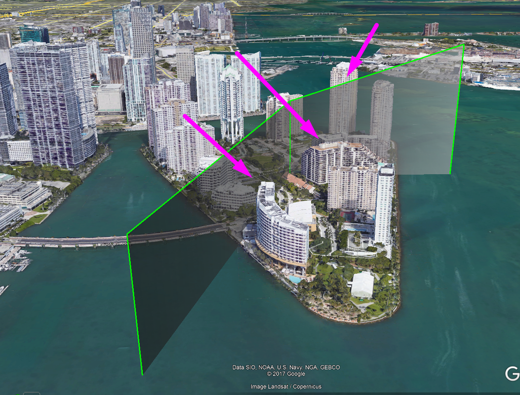
1 Comment
|
AuthorI am the founder of the online series of courses called Phantom Filmschool Archives
May 2018
Categories |
 RSS Feed